
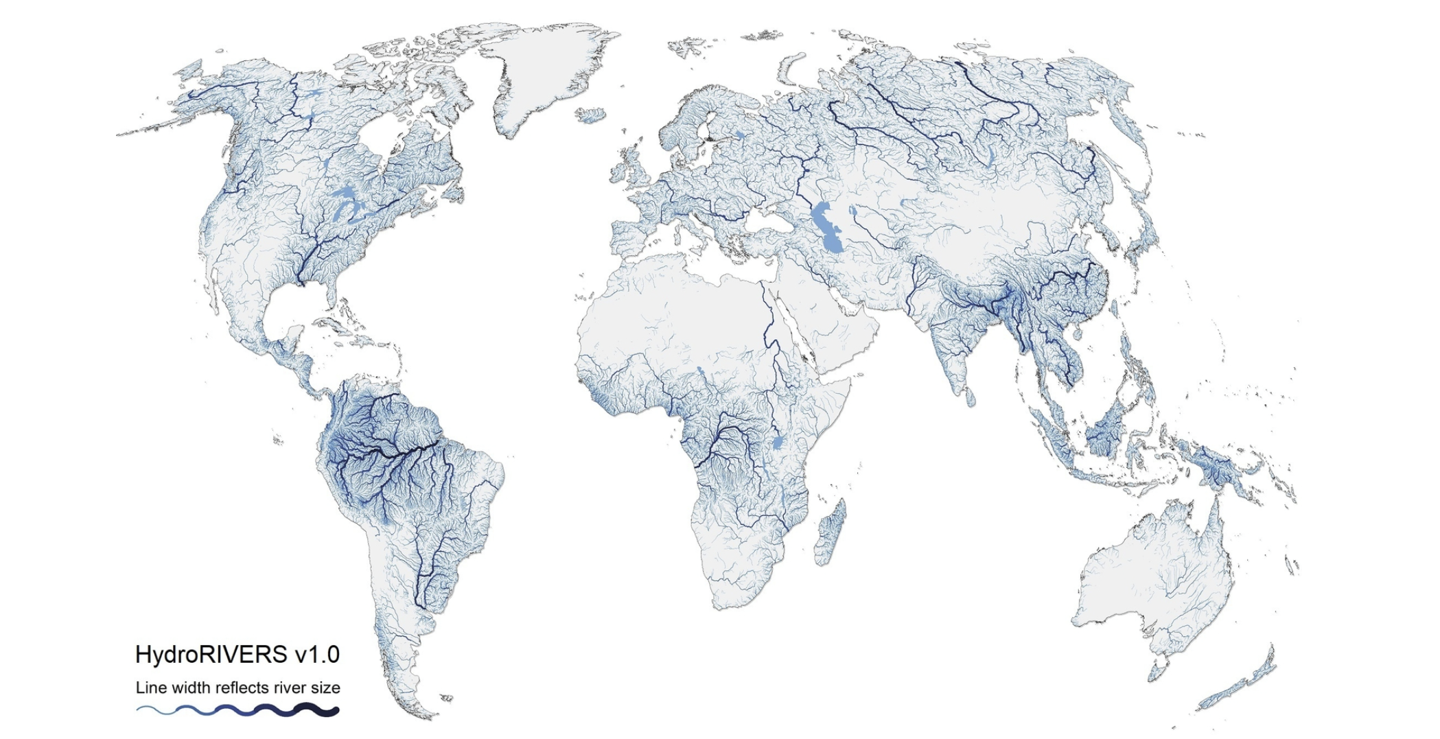
HydroRIVERS represents a vectorized line network of all global rivers that have a catchment area of at least 10 km² or an average river flow of at least 0.1 m³/sec, or both. HydroRIVERS has been extracted from the gridded HydroSHEDS core layers at 15 arc-second resolution. The global coverage of HydroRIVERS encompasses 8.5 million individual river reaches with an average length of 4.2 km, representing a total of 35.9 million km of rivers globally. HydroRIVERS only includes a limited amount of (mostly geometric) attribute information, such as the river reach length, the distance from upstream headwaters and ocean outlet, the river order, and an estimate of long-term average discharge. Every river reach is also co-registered to the sub-basin of the HydroBASINS database in which it resides (via a shared ID).
Note that the overarching HydroATLAS database fully contains all river reaches of HydroRIVERS, which have additionally been enhanced in HydroATLAS with a large number of hydro-environmental characteristics.
https://www.hydrosheds.org/products/hydrorivers