Interactive map of best practices
on the use of water, land and energy resources, as well as the environment of Central Asia
http://www.cawater-info.net/best-practices/ru/base/index
Welcome to our interactive resource, which contains information on best practices for the use of water, land and energy resources, as well as the environment in Central Asia!
What is best practice?
Best practice for the purposes of this resource is the successful application in practice of approaches, technologies, models, techniques, devices, instruments and other tools or combinations thereof that have proven their effectiveness in the field of water, land, energy resources use, as well as environmental protection in Central Asia.
An instrument in this case is understood as an approach, technology, method, or set of methods and measures or process organization for the sustainable and rational use of water, land and energy resources and environmental protection. The Glossary provides more detailed information on the main instruments included in the database.
Criteria for selecting best practices for inclusion in the database
Best practices were selected based on their effectiveness in solving existing problems, sustainability of application without external financial assistance, social and practical significance, scale of implementation and potential for replication in similar conditions. The criteria for inclusion of best practices in this resource also included:
- Recognition of the instruments used by national partners in the countries;
- Wide use of instruments in the country (not on a one-off basis);
- Corresponds to one of the following topics: use of water, land and energy resources, environmental protection.
How to use the map
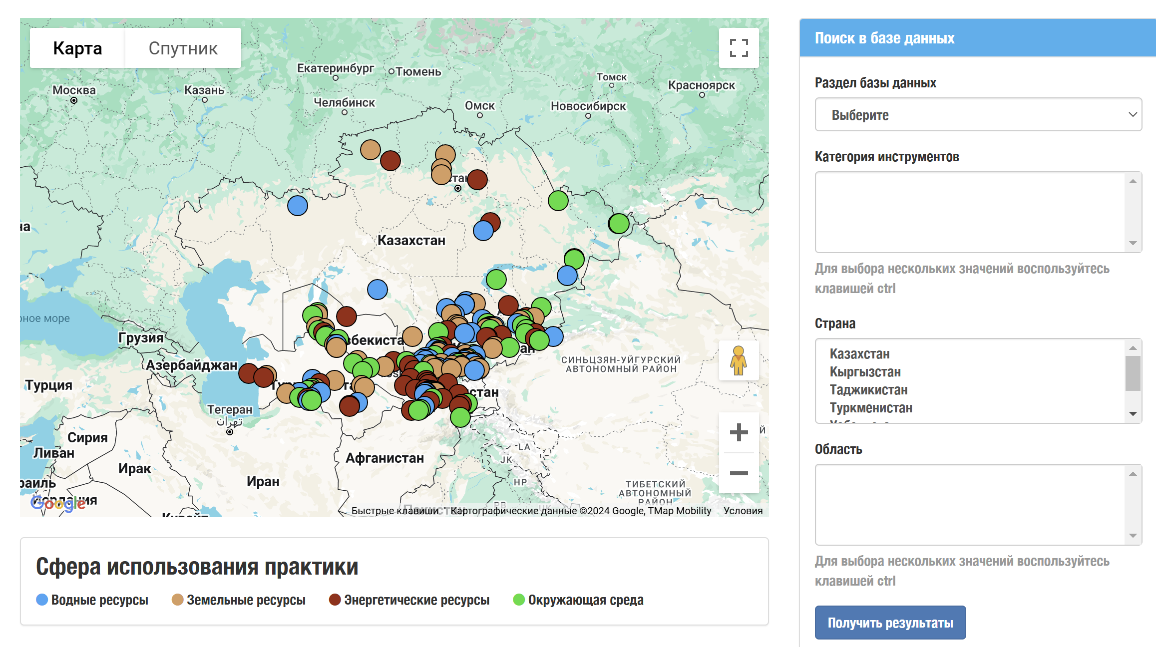
The interactive map is scaled to five Central Asian countries: Kazakhstan, Kyrgyzstan, Tajikistan, Turkmenistan and Uzbekistan. The map scale can be easily changed using the buttons on the map or the computer mouse wheel. The map also supports the “satellite” mode.
The different colored markers on the map represent the different practice areas: “water resources”, “land resources”, “energy resources” and “environment”. Each area has its own color, indicated in the legend below the map.
By default, all practices in the database are displayed on the map as colored markers. When you hover over a marker, a window with the name of the practice pops up, allowing you to quickly and interactively search for relevant practices.
Clicking on the selected marker opens a pop-up window with a brief summary of the practice, allowing the user to quickly determine whether the selected practice is of interest to them. The pop-up window also contains a “more details” link, which, when clicked, opens a page with full information about the selected practice.
The database can be searched by practice areas, by tool category, by country and region. It is also possible to compare practices.

