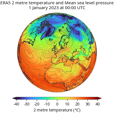
Climate change

Weather data for the NOAA stations of Central Asia

Dataset with weather measurements for the NOAA stations of Kazakhstan, Kyrgyzstan, Tajikistan, Turkmenistan, Uzbekistan, Iran, and Mongolia. The variables are precipitation, snow depth, temperature average, minimum and maximum. The dataset is in Excel format

Climate change

ECMWF ERA5

A first segment of the ERA5 dataset is now available for public use (1979 to within 5 days of real time). ERA5 provides hourly estimates of a large number of atmospheric, land and oceanic climate variables. The data cover the Earth on a 30km grid and resolve the atmosphere using 137 levels from the surface …

ECMWF ERA5 Read More »

Climate change

Copernicus – Global Agriculture project

The Global Agriculture Sectoral Information System (SIS) project has developed climate services in support of decision-making in these contexts. It does so in a process of co-creation with partners representing international crop research, international agricultural policy development and commercial agricultural consultancy services. Four categories of data products haven been produced: Contemporary and historic climate data …

Copernicus – Global Agriculture project Read More »

Climate change

ECMWF Forecasts of mean sea level pressure, temperature, wind speed in Asia

Ensemble mean and spread: from the ECMWF ‘Ensemble Prediction System’ (ENS), for four parameters: mean sea level pressure, 850 hPa temperature, 850 hPa wind speed and 500 hPa geopotential height. These charts are updated once every 12 hours at approximately 08:30 UTC and 20:30 UTC. Each chart header is labelled with the date and time …

ECMWF Forecasts of mean sea level pressure, temperature, wind speed in Asia Read More »

Biodiversity

Agriculture Water Productivity Mapping

Agriculture Water Productivity Mapping for Central-Asia (AWP-CA) is the Google Earth Engine supported on-the fly web mapping tool by harvesting open access data and also calculating derived indices and products for the given period. Tool display data and relative production variability across the region or zoom to specific country. The framework of AWP can be …

Agriculture Water Productivity Mapping Read More »

Industry

Earth Map

Earth Map is an innovative, free and open-source tool developed by the FAO. It was created to support countries, research institutes, farmers and members of the genral public with internet access to monitor their land in an easy, integrated and multi- temporal manner. It provides satellite imagery and global datasets on climate, vegetation, fires, biodiversity, …

Earth Map Read More »

Industry

Ecology Data Portal of the Republic of Uzbekistan

This tool presents various data in the field of health of the Republic of Uzbekistan. Here You can find such data as a list of hospitals, clinics, pharmacies, health resorts, as well as the register of licenses for medical activities, the register of licenses for pharmaceutical activities in the Republic of Uzbekistan. Source: http://data.gov.uz/

Industry

Global Information and Early Warning System on Food and Agriculture (GIEWS)

Global Information and Early Warning System on Food and Agriculture (GIEWS) monitors the condition of major foodcrops to assess production prospects. GIEWS utilizes remote sensing data that can provide a valuable insight on water availability and vegetation health during the cropping seasons. It provide maps and graphs at country level, depicting the latest 36-month period …

Global Information and Early Warning System on Food and Agriculture (GIEWS) Read More »

Industry

Sustainable Land Management Tajikistan

Sustainable Land Management Tajikistan (SLMTJ) is a knowledge platform on Sustainable Land Management in Tajikistan. The SLMTJ Knowledge Platform will provide access to the knowledge materials and aims to strengthen the collection, sharing and dissemination of best practices and methodologies on SLM among different stakeholders. Source: https://slmtj.net/

Scroll to Top