
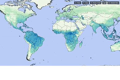
The Food and Agriculture Organization (FAO) announces the expansion of the geographical coverage of one of its key water resource management tools – WaPOR. This innovative tool, well-known for its application in Africa and the Middle East for the past six years, is now broadening its functionality to a global scale.
WaPOR provides real-time access to satellite data for monitoring actual water usage on agricultural plots, irrigation, and calculating the economic value associated with water resource utilization. This enhancement becomes an invaluable asset for countries grappling with water scarcity, aiding them in controlling water resource productivity and identifying opportunities to enhance water use efficiency.
Lifeng Li, Director of the FAO Land and Water Division, emphasizes the contribution of WaPOR to bolstering the prospects of optimizing and ensuring the reliability of agricultural yields through scientifically informed methodologies. With an expanded array of satellite data and the adaptability of resolutions to various field scales, where each pixel represents an area of 20 square meters, farmers can now make well-informed decisions regarding the optimal timing for irrigation and the required volume of water for successful cultivation.
Giuseppe Hugévin, Chief Technical Advisor of the WaPOR program, underscores the importance of obtaining more precise data. These data enable governments to formulate more comprehensive rural development strategies and better track the achievement of Sustainable Development Goals. It is worth noting that the extended WaPOR data are accessible to all FAO member countries and the general public.
The WaPOR project is financially supported by the Government of the Netherlands and addresses critical aspects of water use efficiency, optimization methods, and the determination of water and energy prices. The application of WaPOR can significantly contribute to the assessment of marginal water use costs and the added value of water resource utilization. This, in turn, aids in the decision-making process for both planning authorities and small-scale farmers, promoting more efficient water resource management.
To illustrate the point, consider the application of WaPOR in the Bekaa Valley, Lebanon, where irrigating winter potatoes, though water-intensive, yields tenfold more profit than wheat. This raises the crucial question of optimizing water resource utilization to strike a balance between food security and economic profitability.
Geospatial data provided by WaPOR is complemented by empirical on-ground research, facilitating the identification of best agricultural management practices. Leading financial institutions and development organizations, including the World Bank, the European Bank for Reconstruction and Development, the African Development Bank, the Green Climate Fund, and the Global Environmental Facility, successfully integrate WaPOR into their projects.
With the incorporation of WaPOR into the “Hand in Hand” geospatial platform, the FAO offers a broader spectrum of investment opportunities led by countries in rural development. Don’t miss this chance to deepen your understanding and foster efficient utilization of water resources in the pursuit of a sustainable future.