
It appeared only 113 years ago – Lake Sarez. It was born in a landslide, destruction and chaos. And, ironically, it will end its existence in exactly the same way.
17 cubic kilometers of water are locked in a narrow river valley in the mountains of Tajikistan. Their keeper is a natural dam 567 meters high made of soil and rock debris. If it breaks, all the water will rush down at high speed at one moment under great pressure.
The hidden potential of Lake Sarez was discussed back in Tsarist Russia, continued to be scrupulously studied in the USSR, and now the few local residents of mountain villages have a clear plan of action in case of a breakthrough. And there is something to be afraid of.
How Lake Sarez was born
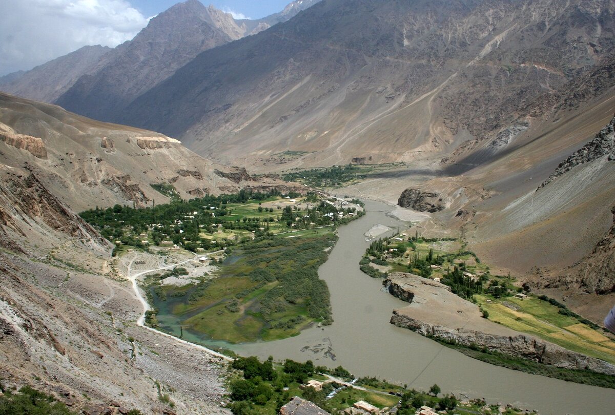
The mountain river Bartang, fed by melt waters of snow and glaciers of the Pamirs, meandered like a silver stream, hissing as it ran through a narrow mountain gorge. In it, under the overhanging mountains, there were a couple of villages, separated by 20 km – Sarez and Usoi. The lake would take them.
The upper reaches of the Bartang River are called Aksu by the locals, the middle reaches – where the events take place – Mugrab. Therefore, when reading different sources, confusion may arise
Late in the evening, on February 18, 1911, at 11:31 p.m., people woke up from strong tremors and a subsequent deafening roar. The plates under the Pamirs were moving again. The echoes of the earthquake were even recorded by seismographs in St. Petersburg at the Pulkovo Observatory, located 3,800 km away.
On the earthquake intensity scale, it was rated at 9 out of 12, which is defined as “destructive” in qualitative terms. On the Richter scale, the magnitude was 7.4 out of a range of 1 to 9.5.
A cold winter morning arrived. The residents of Sarez, who had lived through a night full of excitement and uncertainty, saw a thick and suffocating curtain of dust instead of the usual crystal clear high-mountain air.
We will never know what the residents of Usoy, a village located 20 km downstream from Sarez, experienced. Of all its inhabitants, only three people survived. And those were the ones who had come to visit relatives in Sarez the day before, stayed late and stayed overnight.
People rushed to help their neighbors. Around the next sharp turn of the valley, they saw a dark colossus in the distance. And the closer they got to it, the clearer it became what had happened. The village of Usoy was completely buried in a giant landslide.
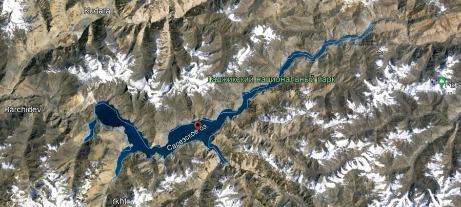
Scientists will calculate later that a mountain massif with a volume of 2 cubic kilometers and a mass of 6 billion tons collapsed. This was enough to completely block a valley 5 kilometers wide, through which the Bartang River flowed. This is how the highest dam in the world was formed – 567 meters high. Which, in memory of the village, is called the Usoi Dam .
“Responsible” for this Pamir corner of the Russian Empire was Staff Captain Zaimkin. Two months later, in April, he quickly reached the place from where there were reports of an earthquake with exceptional consequences.
And he will be unpleasantly surprised: in his report to his superiors he will write about Usoy, who is no longer there, and about the huge mountain blockage of mud and rock, the height of which the staff captain estimated at 650 meters. And about the small lake that the river had already formed, which encountered an insurmountable obstacle on its way: water began to accumulate in front of the blockage.
But Zaimkin will be much more puzzled in September, when he returns to the territory entrusted to him again. He will be surprised to see that the small lake has already turned into a full-flowing, large lake. And the residents of Sarez, located 20 km upstream from the blockage, are already preparing to move: the water is about to reach the village. They turned out to be very far-sighted: already in October, the roof of the last house in Sarez will disappear under water.

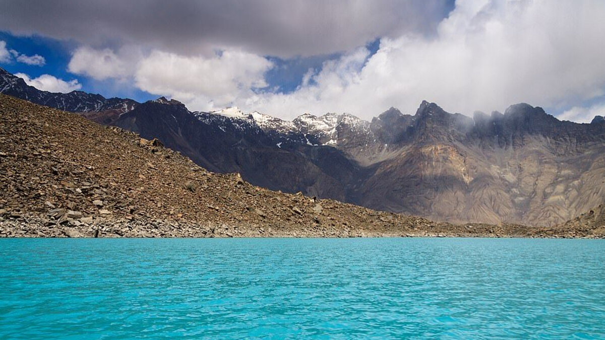
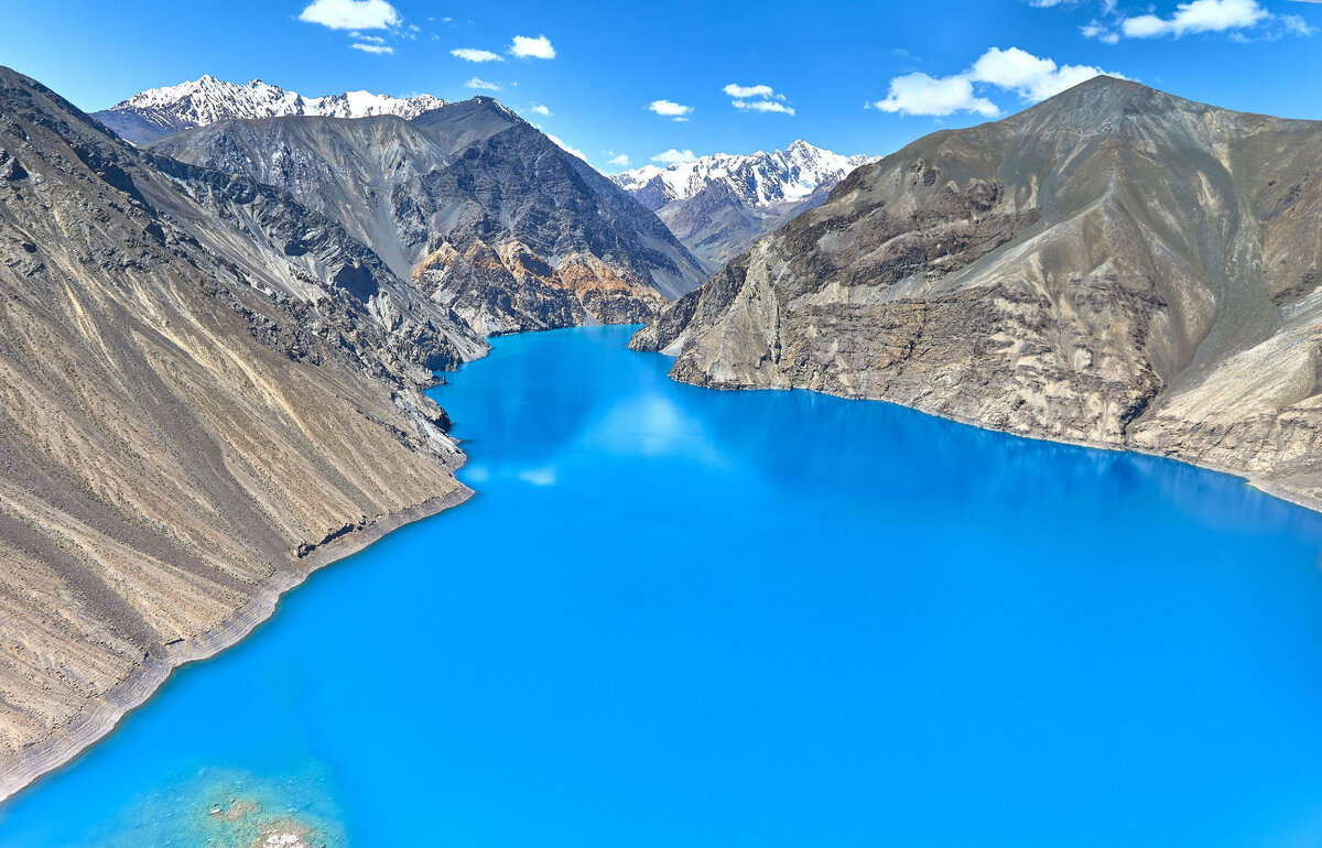
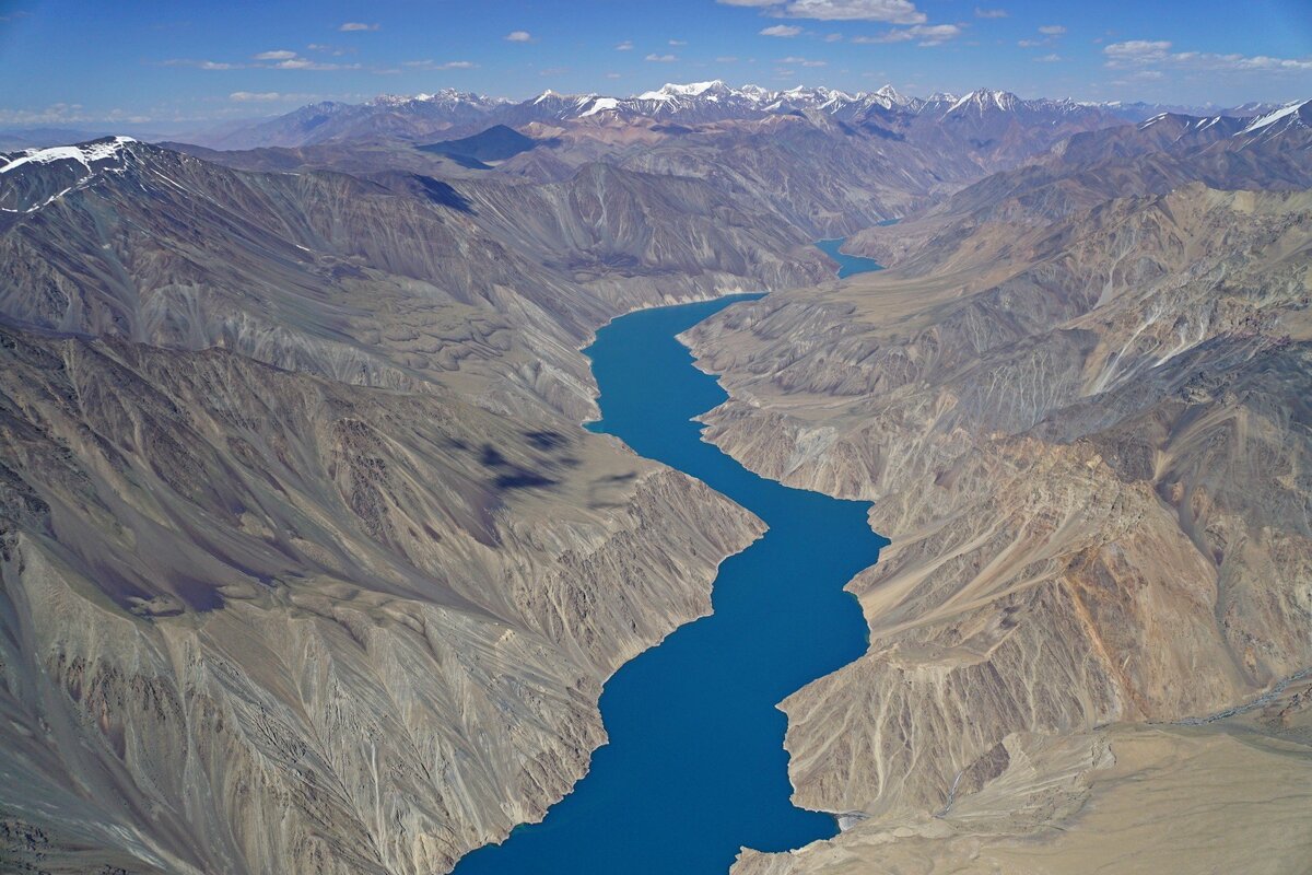
Thus, at an altitude of 3255 meters above sea level, the Sarez Lake of the dam type was born. Today, it is a huge volume of water of 17 cubic kilometers. It filled the river valley in front of the Usoi dam for 70 km upwards, rising to 185-505 m. Sarez, in memory of which the lake received its name, is today at a depth of 240 m.
The rapid filling of the lake ended 15 years after the earthquake, in 1926. Before that, the depth increased by 9 meters per year.
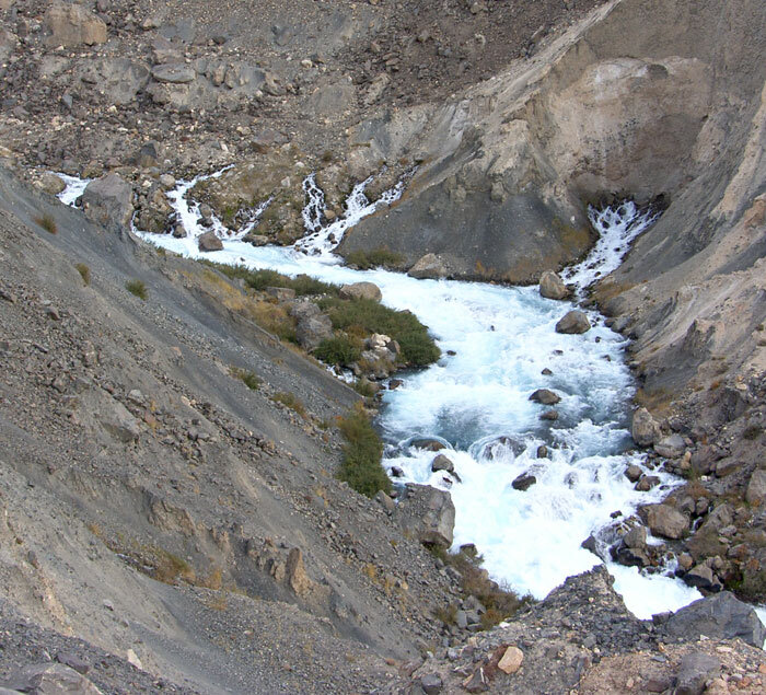
It seemed that at this rate the water would sooner or later gush over the blockage, but… nature knows how to balance. Since 1942 the water level has begun to fluctuate, but plus or minus remains the same to this day. The water found a way: it began to emerge from the other side of the blockage in small “springs”. Today there are 57 of them.
Why Lake Sarez Poses a Great Danger for Central Asia
The news about the appearance of a new lake of unprecedented (for a dam-type lake) size at the time created a furor in the scientific community. Everyone immediately rushed to discuss two important things: “Did the earthquake cause the landslide or vice versa?” and “What will happen if the dam breaks through?”
The threat of a natural dam breaking is real. And, what is most unpleasant, it can happen at any moment. Three scenarios are considered:
-
Lake Sarez is located in a zone of high seismic activity . On average, an earthquake of magnitude 7 occurs here every 100 years. And an earthquake of magnitude 8-9 occurs once every 250-2000 years. The power of both the first and especially the second would be enough to produce an effect opposite to the tremors of 1911: to destroy the rubble.
-
The dam itself , made of soil and rocks, can be washed away by water seeping through it. Any thin stream passing through the blockage is ready to become a fatal illustration of the proverb “Where it’s thinnest, there it breaks!” Complex processes occur here: in one place, the water crushes the blockage from the inside, in another, the leaks are plugged. This is almost a living organism, the behavior of which cannot be calculated even by the most advanced artificial intelligence.
-
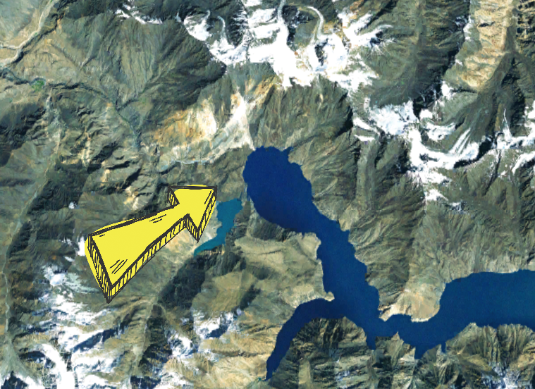
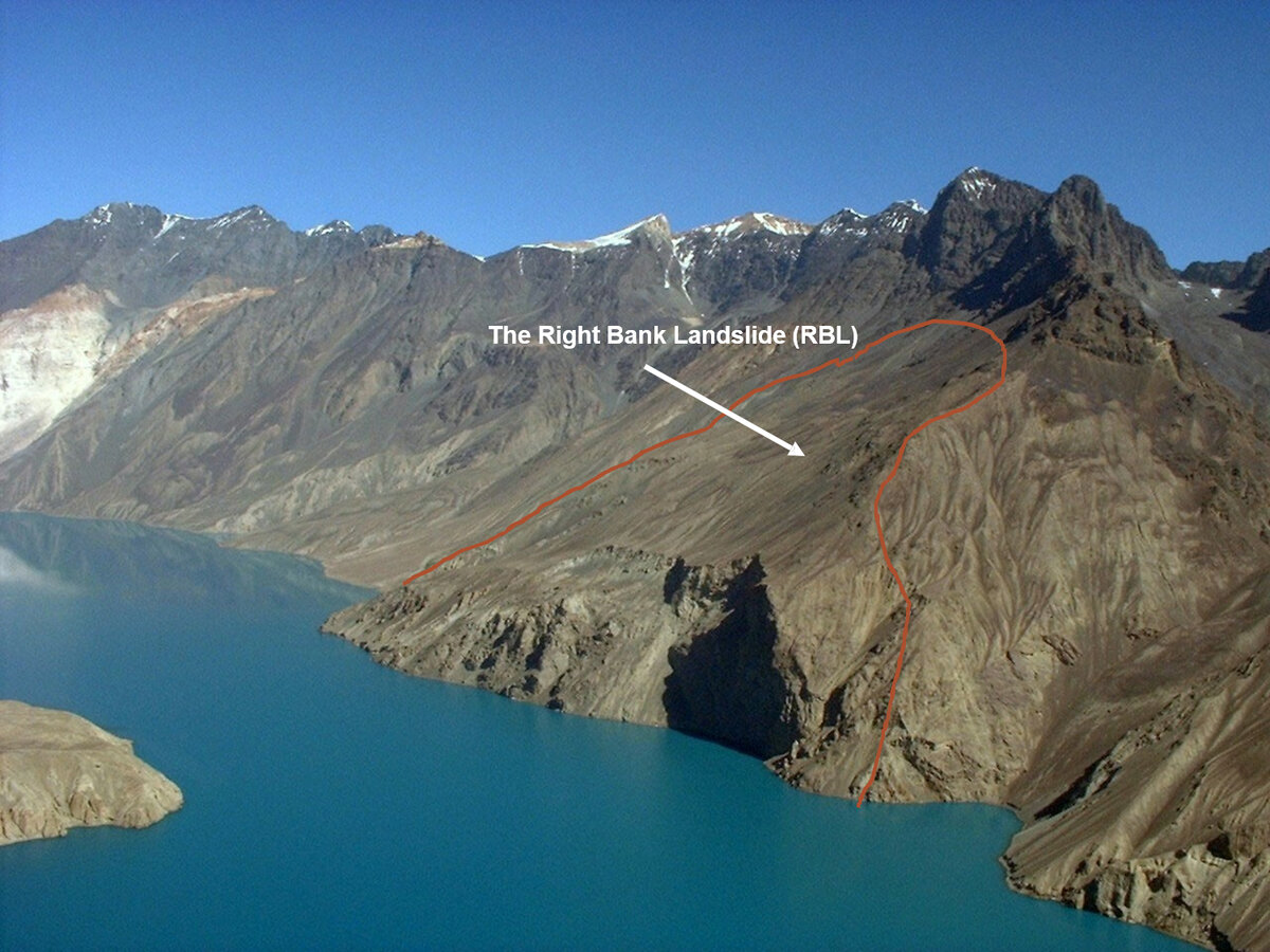
In 1967, another unfavorable scenario was added: a section was discovered on the right bank of the lake from which a landslide could occur . Especially if you see point 1, about earthquakes. There, too, 0.5-2 loose cubic kilometers of slope (the exact volume varies with each researcher) are waiting in the wings, according to geologists’ estimates, ready to repeat the fall of their former comrade from the opposite side of the valley. If all this falls into Sarez, the water will gush over the rubble and eventually destroy it.
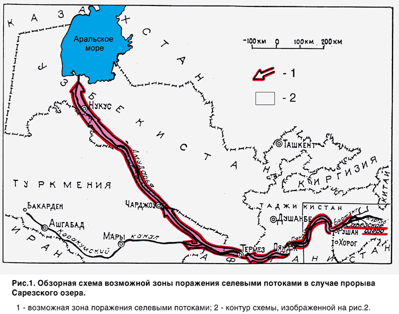
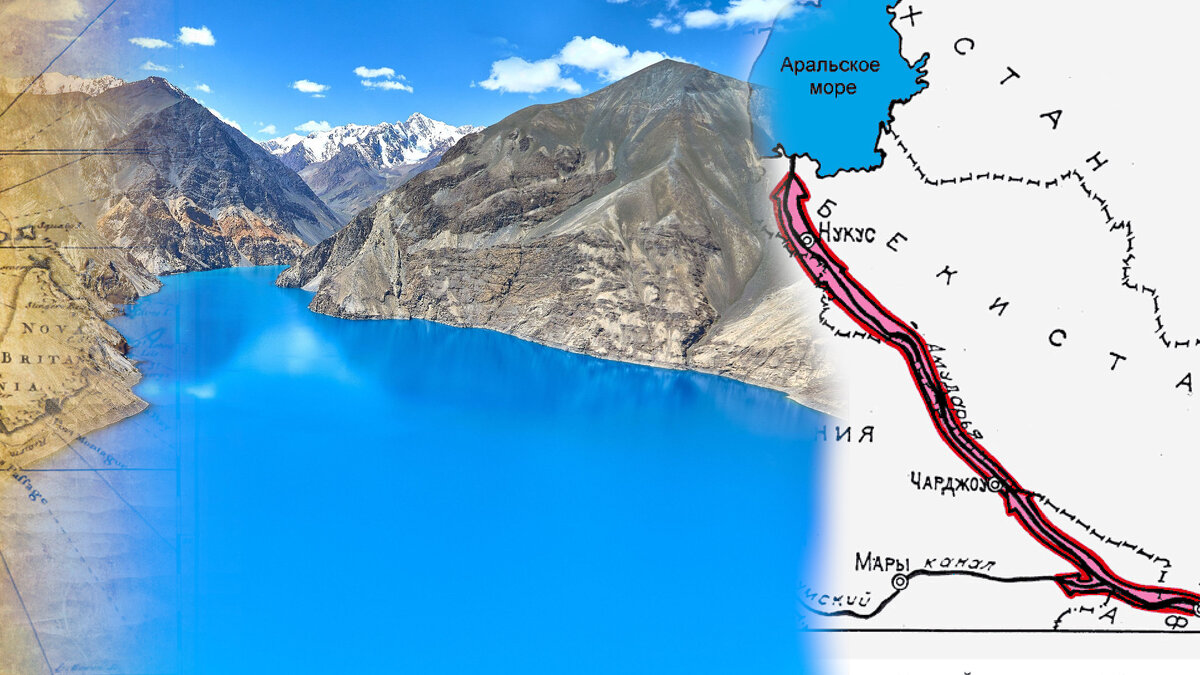
All three options will lead to significant consequences in the cube. In an attempt to make a sad joke, we can say that this is the most original way to refill the Aral Sea. In the event of a breakthrough of Lake Sarez, the water flows, having collected soil and stones, will quickly pass as a mudflow to the very lower reaches of the Amu Darya .
After all, the “access zone” of Lake Sarez includes territories located along the Bartang-Panj-Amu Darya river chain and 6 million people in Afghanistan, Tajikistan, Turkmenistan and Uzbekistan. Bartang does not stop in Lake Sarez: the water that manages to break through the body of the blockage continues its journey further.

On the one hand, there are many dammed lakes in the world and they are prosperous. But Sarez is exceptional in its scale. Moreover, research has shown that at least 9 dammed lakes used to exist in this area. Where are they now? They are gone. Their dams were washed away or destroyed. The last one, Prasarez Lake, about which we know more due to its relative “freshness”, had part of its 4-kilometer dam washed away.
-
Lake Sarez is a large body of water with a height of 567 m.
-
It is located at an altitude of 3,255 m, so the streams will fly down the narrow river valleys at great speed.
-
The most daring negative forecasts say something about a wave 120 meters high.
All this makes one wonder how one can keep the 6,000,000 people living downstream safe.
Is it possible to stop Sarez: started with a tunnel, ended with an observation booth
The grandeur of the Usoi phenomenon makes us think about the weakness of human forces,
– Captain Grigory Shpilko, one of the first explorers of Lake Sarez
Soviet scientists came up with a very sensible plan to build a tunnel with a hydroelectric power station through which a controlled discharge of water would take place. Everything about this project was perfect: control over the volume of Sarez, the generation of electricity for local residents, and the regular flow of water to arid Central Asia, which constantly has nothing to water its cotton with.
In 2000, Tajikistan, Uzbekistan, Kyrgyzstan and Kazakhstan appealed to the world community. They wanted the best minds to take on the problem of a possible breakthrough of Sarez. Well, and to finance it. It didn’t work out very well.
The solution was the same as the funding allocated. An observation booth was installed on Lake Sarez . It was supposed to transmit a signal that would launch a warning system in the settlements below. Skeptics pointed out that Sarez’s power was underestimated: if the breakthrough was global, the booth could be the first to be washed away. Before it could transmit the signal.
There was enough funding to create primitive ” safety islands ” on the surrounding hills for those living near Sarez. With supplies of water, food and basic necessities. That was the end of the solution to the problem.
In the event of a strong earthquake, none of these options will help. Therefore, Lake Sarez remains an excellent repository of the purest mountain water, hiding the power of destruction that our Planet is capable of.