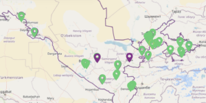
Datasets

Kazakhstan

RiverBP.net

RiverBP.net (Eurasian River Basin Management Portal) is a key information resource in Central Asia dedicated to integrated water resources management (IWRM) . To put it simply, it is a “digital knowledge base” for everyone involved in the region’s transboundary rivers. The main directions of the site: Monitoring and data: Collection of up-to-date information on large

Read More »

WorldStrat dataset

WorldStrat dataset (https://worldstrat.github.io) contains free high- and medium-resolution satellite images with a total area of about 10 thousand square meters. km, which provide a stratified representation of the main land use types around the world.   Each high-resolution image (1.5 m/pixel) is accompanied by several corresponding medium-resolution images from Sentinel-2

Read More »

UNCCD Data Dashboard

A site where core topics under our mission and mandate can be explored through the information submitted by country Parties in their national reports during the 2022 reporting process Land degradation and drought Resources mobilized to combat desertification, land degradation and drought People exposed to land degradation and drought National

Read More »

Climate Data Store ERA5 hourly data on single levels from 1940 to present

https://cds.climate.copernicus.eu/datasets/reanalysis-era5-single-levels?tab=download  ERA5 is the fifth generation ECMWF reanalysis for the global climate and weather for the past 8 decades. Data is available from 1940 onwards. ERA5 replaces the ERA-Interim reanalysis. Reanalysis combines model data with observations from across the world into a globally complete and consistent dataset using the laws of

Read More »

HydroSHEDS tools

The HydroSHEDS project was initiated in 2006 by World Wildlife Fund US with the goal to create free digital data layers in support of large-scale hydro-ecological research and applications worldwide. HydroSHEDS provides seamless hydrographic data products including catchment boundaries, river networks, and lakes. The various existing sub-datasets are consistent across

Read More »
Uzbekistan

Interactive map of air quality monitoring in Uzbekistan

Together with the International Public Foundation “Zamin”, 16 new automatic stations have been installed in the administrative centers of Andijan, Bukhara, Kashkadarya, Navoi, Namangan, Tashkent and Fergana regions, as well as in the city of Tashkent, which transmit reliable information to the website monitoring.meteo.uz every 10 minutes.

Read More »
Scroll to Top