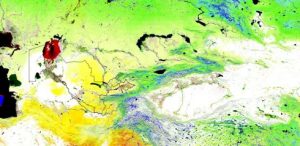
Earth Map

Earth Map is an innovative, free and open-source tool developed by the FAO. It was created to support countries, research institutes, farmers and members of the genral public with internet access to monitor their land in an easy, integrated and multi- temporal manner. It provides satellite imagery and global datasets on climate, vegetation, fires, biodiversity, geo-social and other topics. Users need no prior knowledge of remote sensing or Geographical Information Systems (GIS).

Source: https://earthmap.org/

Read More »

Central Asia ADAPT

The Central Asia Water & Energy Data Portal is available in English and Russian language and covers the five countries of Central Asia including Afghanistan. The data portal includes many new high-quality datasets available from a number of institutions (e.g. UN agencies, NASA, NOAA, CIESIN, IRI, The World Bank, etc.). It contains datasets on various topics, such as: Environment, Social, Economic, Climate, Water, and Disaster

Source: https://crva.centralasiaclimateportal.org

Read More »
Scroll to Top