

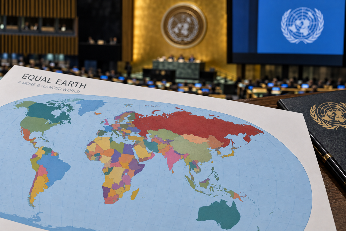
On September 4, 2026, the UN General Assembly approved the “Correct the Map” resolution, calling for the use of a world map that more accurately depicts the actual size of continents, particularly Africa, the UN press service reported.
A total of 164 countries voted in favor of the resolution, initiated by Togo and supported by African Union member states. The United States was the only country to vote against. Six other countries—Estonia, Georgia, Lithuania, Moldova, Serbia, and Ukraine—abstained.
The initiative stems from criticism of the widely used Mercator projection. This map has been in use since the 16th century, but due to the projection’s peculiarities, it distorts the size of territories.
In particular, Africa on the Mercator map appears visually roughly comparable to Greenland, despite its area being approximately 14 times larger. Territories located near the equator appear smaller relative to regions and countries located closer to the poles.
Critics say such visual distortion could downplay Africa’s importance, its economic potential and its development needs.
What is the Mercator projection? The Mercator projection was created in 1569 by the Flemish cartographer Gerardus Mercator. It was intended to assist European navigators during long-distance voyages. Distortions arise from the impossibility of accurately transferring the globe’s surface onto a flat two-dimensional map.
Therefore, certain compromises must be made when creating any world map. Attempts to change the map In 2018, a group of cartographers developed the Equal Earth projection, which allows for more accurate comparisons of territorial areas.
In February 2026, all 54 member states of the African Union adopted this projection, declaring that it more accurately depicts the sizes of all continents, especially Africa.
Participants in the #CorrectTheMap campaign note that Africa could accommodate the United States, China, India, Japan, Mexico, and a significant portion of Europe, with room left over.
Controversy surrounding the decision. On the eve of the vote, Togolese Foreign Minister Robert Dusset stated that “a just world begins with a just map.” He argued that maps influence how people and continents perceive their place in the world.
French Foreign Minister Jean-Noël Barrot also supported the initiative and stated that his department would stop using Mercator projection maps.
US Ambassador to the UN Yarina Ferentsevich, on the other hand, criticized the resolution. She stated that instead of addressing the real problems of the international community, the General Assembly is discussing 16th-century cartographic projects and their role in promoting reparations and “cognitive justice.
” Essentially, the General Assembly resolution recognizes a fundamental problem that no vote can resolve. No projection can perfectly reproduce the Earth’s curved surface on a flat surface. Each one sacrifices something—area, shape, distance, or direction—and each one is suitable for different purposes.
The UN General Assembly resolution is non-binding, and the Mercator projection is here to stay. However, Friday’s vote demonstrated overwhelming international support for an argument increasingly advanced by African countries: the choices embedded in maps can influence how generations of people perceive the world around them.
Google machine translated