Climate Impacts in Central Asia

The “ClimateImpactsOnline” portal is a result of research on climate impact for different sectors (agriculture, forestry, hydrology, energy and tourism) developed at the Potsdam Institute for Impact Research Climate (PIK). Within the portal, parameters such as temperature, crop yields or forest fire risk can be selected and displayed for various time periods. The selected parameters are shown as a color map and detailed representations can be accessed via three integrated zoom levels by clicking on selected regions. In addition, the portal provides teaching materials, background information and a glossary. PIK released the first version of the portal for Germany in 2013 and made available the versions for Peru, India and Tanzania by 2021. Meanwhile, the Sahel region and Central Asia are available as well. To be updated on the most recent developments, you can join the ClimateImpactsOnline mailing list.

Source: http://kfo.pik-potsdam.de//ca/index_en.html?language_id=en

The Crop Growth Monitoring System for Central Asia (CGMS-CA)

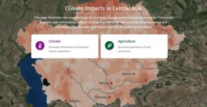
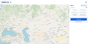
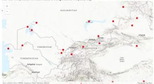
The Crop Growth Monitoring System for Central Asia (CGMS-CA) allows monitoring the conditions for the growth and development of crops and forecasting their yields for the countries of the Central Asian region, including Kazakhstan, Uzbekistan and Turkmenistan. CGMS-CA allows to assess the conditions of growth, development and accumulation of productive biomass in a significant list of agricultural crops in the region – winter wheat, spring wheat, cotton, spring rapeseed, lentils and rice. For each country of the region, the system has been adapted, considering some specifics of each one in terms of information, methodology and technology. The main steps of technological adaptation of the CGMS-CA system includes: development of a meteorological database for the certain period (not less than 10 years) using standard meteorological observations of the Hydrometeorological network and free available NASA Power data (https://power.larc.nasa.gov/); development of a soil characteristics database, by finding a correspondence between the taxonomy of the digital soil map and the classification of soils WRB; development of a phenological characteristics database such as sown dates, dates of emergence, anthesis and maturity obtained from agrometeorological stations network of the National Hydrometeorological services of the region; development of a statistical crop yields database at the regional and district levels of each country of the region. One of the main specifics of the CGMS-CA are estimation of biophysical parameters of crop development based of simulations of WOFOST (WOrld FOod Studies) model and possibility to display the results of the simulations at the different administrative levels based on a spatial schematization and aggregation. The prediction of crop yields in the context of administrative units is based on statistical methods (pair and multiple regression). CGMS-CA has been developed by specialists of the Ukrainian Hydrometeorological Institute (https://uhmi.org.ua/) as part of a joint project with the Regional Environmental Center of Central Asia (https://carececo.org/main/)

Source: https://cgms-ca.uhmi.org.ua/

AReS

The Agricultural Research e-Seeker (AReS) is a tool to discover, explore, and retrieve content from information and data repositories linked to CGIAR and its partners. It is designed to help make CGIAR knowledge findable, accessible, inter-operable and re-usable.

Source: http://cgspace.cgiar.org/

GIEWS Food and Agriculture Early Warning

Global Information and Early Warning System on Food and Agriculture (GIEWS) monitors the condition of major foodcrops to assess production prospects. GIEWS utilizes remote sensing data that can provide a valuable insight on water availability and vegetation health during the cropping seasons. It provide maps and graphs at country level, depicting the latest 36-month period of the seasonal, vegetation and precipitation indicators. and presenting data by dekad and month.

Source: http://www.fao.org

SoilGrids

SoilGrids is a system for global digital soil mapping that uses state-of-the- art machine learning methods to map the spatial distribution of soil properties across the globe. SoilGrids prediction models are fitted using over 230 000 soil profile observations from the WoSIS database and a series of environmental covariates.

Source: https://soilgrids.org/

Google Earth

Google Earth is a computer program that renders a 3D representation of Earth based primarily on satellite imagery. The program maps the Earth by superimposing satellite images, aerial photography, and GIS data onto a 3D globe, allowing users to see cities and landscapes from various angle.

Source: https://www.google.com/earth/

Food Systems Dashboard

The food system is all of the people and activities that play a part in growing, transporting, supplying, and, ultimately, eating food. These processes also involve elements that often go unseen, such as food preferences and resource investments.

Source: https://foodsystemsdashboard.org/

Global Reservoirs and Lakes Monitor (G-REALM)

G-REALM provides time-series of water level variations for some of the world’s largest lakes and reservoirs. Currently, lakes ≥ 100km2 are included but future project phases will aim to include those in the 50-100km2 size range.

Source: USDA/FAS/OGA

Earth Map

Earth Map is an innovative, free and open-source tool developed by the FAO. It was created to support countries, research institutes, farmers and members of the genral public with internet access to monitor their land in an easy, integrated and multi- temporal manner. It provides satellite imagery and global datasets on climate, vegetation, fires, biodiversity, geo-social and other topics. Users need no prior knowledge of remote sensing or Geographical Information Systems (GIS).

Source: https://earthmap.org/

WUEMoCA

Water Use Efficiency Monitor in Central Asia (WUEMoCA) is an operational scientific web mapping tool for the regional monitoring of land and water use efficiency in the irrigated croplands of the transboundary Aral Sea Basin that is shared by Kazakhstan, Kyrgyzstan, Tajikistan, Turkmenistan, Uzbekistan, and Afghanistan. Satellite data on land use, crop production and water consumption are integrated with hydrological and economic information to provide of a set indicators.

Source: https://wuemoca.geo.uni-halle.de/app/

Scroll to Top